Trail Canoe - kayak Cassis - 
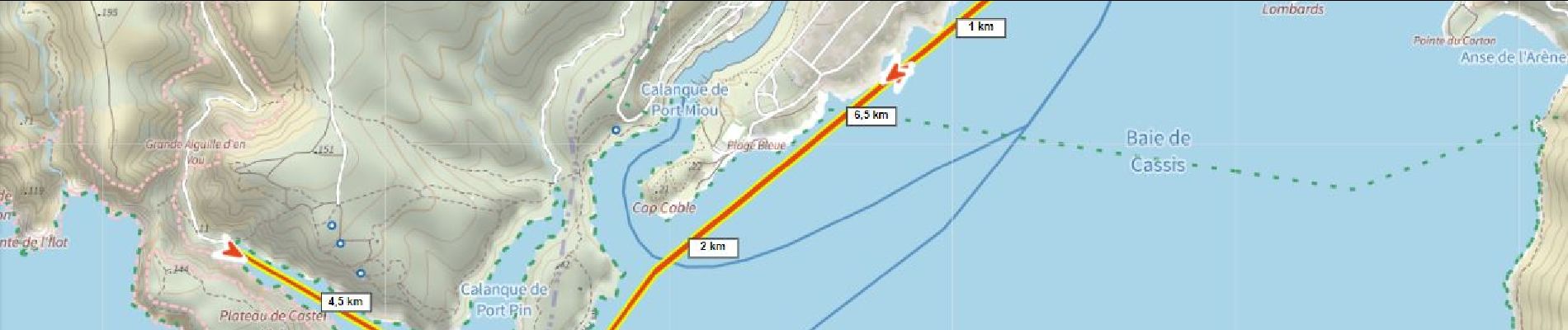
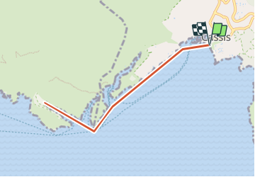
Calanque d'EnVau depuis Cassis - Photo
© OpenStreetMap contributors
Length
Length
8.1 km
Max alt
Max alt
31 m
Uphill gradient
Uphill gradient
119 m
Km-Effort
Km-Effort  
9.7 km
Min alt
Min alt
-6 m
Downhill gradient
Downhill gradient
119 m
Boucle
Boucle
Yes
Creation date :
2023-06-19 20:42:28.64
Updated on :
2023-06-21 11:08:05.029

(0 Reviews)

Canoe - kayak
Canoe - kayak
4h00
Difficulty : Medium

Scan this QR Code to open this trail in the SityTrail application

FREE GPS app for hiking

Logo SityTrail SityTrail

IGN / Geographical institutes

Download SityTrail from the App Store Download SityTrail from Google Play

Logo SityTrail SityTrail Plus

The world is yours!

Download SityTrail from the App Store Download SityTrail from Google Play Download SityTrail on Huawei AppGallery

About

Trail Canoe - kayak of 8.1 km to be discovered at Provence-Alpes-Côte d'Azur, Bouches-du-Rhône, Cassis. This trail is proposed by ericberlin.

Description

Partir très tôt le matin pour éviter la chaleur et le vent qui se lève.
Prévoir chapeau T-shirt gants et beaucoup d'eau.
Prendre la météo et choisir un jour sans vent.

https://cassis-kayak.com/
https://www.lokayakcassis.com/

Elevation profile

Photos

Positioning

Country:
France
Region :
Provence-Alpes-Côte d'Azur
Department/Province :
Bouches-du-Rhône
Municipality :
Cassis
Location:
Unknown
Start:(UTM)
706162 ; 4787537 (31T) N.


Close
My subscriptions