


conversaria pic st Michel

lionelnottat
User
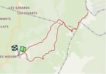

Length
12.4 km

Max alt
1965 m

Uphill gradient
841 m
Km-Effort
24 km

Min alt
1173 m

Downhill gradient
845 m
Boucle
Yes
Creation date :
2023-06-20 06:49:19.351
Updated on :
2023-06-20 12:39:24.148
3h54
Difficulty : Difficult
3h54
Difficulty : Medium

FREE GPS app for hiking
 SityTrail
IGN / Geographical institutes
SityTrail Plus
The world is yours!
About
Trail Walking of 12.4 km to be discovered at Auvergne-Rhône-Alpes, Isère, Villard-de-Lans. This trail is proposed by lionelnottat.
Positioning
Country:
France
Region :
Auvergne-Rhône-Alpes
Department/Province :
Isère
Municipality :
Villard-de-Lans
Location:
Unknown
Start:(Dec)
Start:(UTM)
703060 ; 4994232 (31T) N.
Comments