


Queyras 06 -

uru2010
User
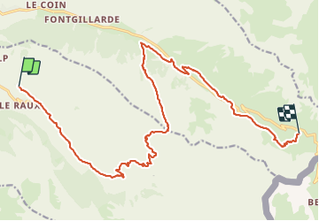

Length
21 km

Max alt
2702 m

Uphill gradient
1239 m
Km-Effort
35 km

Min alt
2004 m

Downhill gradient
704 m
Boucle
No
Creation date :
2023-06-18 06:37:06.323
Updated on :
2023-06-20 15:26:58.822
8h13
Difficulty : Very difficult

FREE GPS app for hiking
 SityTrail
IGN / Geographical institutes
SityTrail Plus
The world is yours!
About
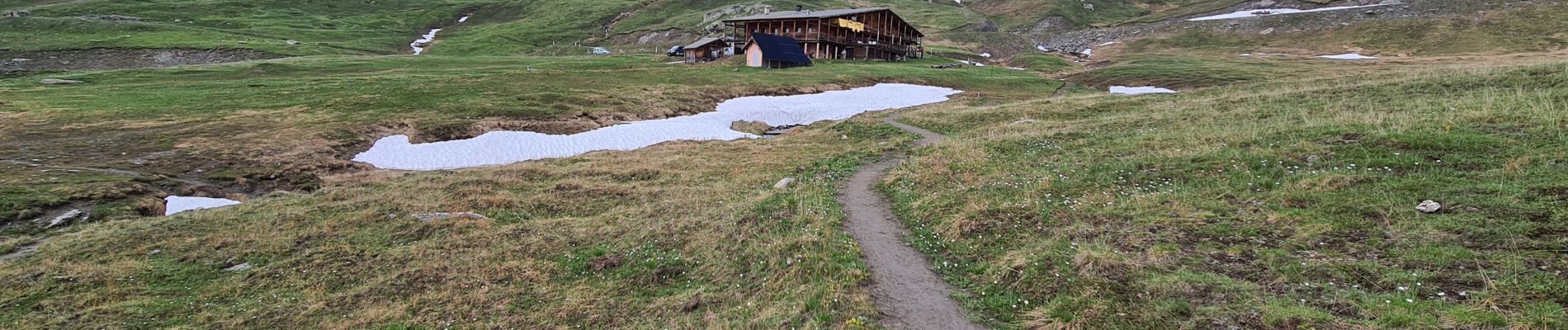
Trail Walking of 21 km to be discovered at Provence-Alpes-Côte d'Azur, Hautes-Alpes, Saint-Véran. This trail is proposed by uru2010.
Photos


Positioning
Country:
France
Region :
Provence-Alpes-Côte d'Azur
Department/Province :
Hautes-Alpes
Municipality :
Saint-Véran
Location:
Unknown
Start:(Dec)
Start:(UTM)
330677 ; 4952247 (32T) N.
Comments