


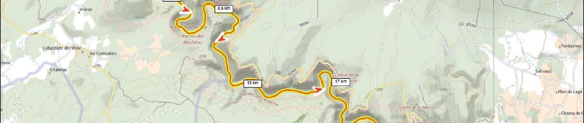
SityTrail - gorge de l Ardèche vallon - sauze

ericberlin
User


6h00
Difficulty : Very difficult

FREE GPS app for hiking
 SityTrail
IGN / Geographical institutes
SityTrail Plus
The world is yours!
About
Trail Canoe - kayak of 25 km to be discovered at Auvergne-Rhône-Alpes, Ardèche, Vallon-Pont-d'Arc. This trail is proposed by ericberlin.
Description
Temps donné pour l entièreté de la balade pause comprise (environ 1h30).
Très beau paysage, de nombreux oiseaux et quelques couleuvres à observer !
Un régal.
Descente faite avec Loulou bateau 👌
Photos

Positioning
Comments