


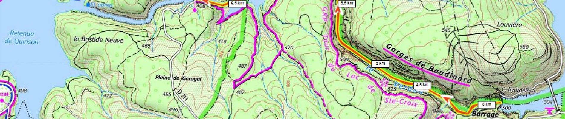
SityTrail - Gorges de Baudinard

ericberlin
User
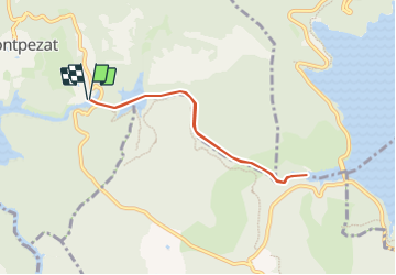

Length
6.9 km

Max alt
488 m

Uphill gradient
192 m
Km-Effort
9.4 km

Min alt
398 m

Downhill gradient
192 m
Boucle
Yes
Creation date :
2023-06-20 17:26:50.498
Updated on :
2023-06-20 17:31:21.778
3h00
Difficulty : Easy

FREE GPS app for hiking
 SityTrail
IGN / Geographical institutes
SityTrail Plus
The world is yours!
About
Trail Canoe - kayak of 6.9 km to be discovered at Provence-Alpes-Côte d'Azur, Alpes-de-Haute-Provence, Montagnac-Montpezat. This trail is proposed by ericberlin.
Description
De Montpezat au pont Sylvestre départ en canoë vers le barrage de St Croix et retour.
Photos

Positioning
Country:
France
Region :
Provence-Alpes-Côte d'Azur
Department/Province :
Alpes-de-Haute-Provence
Municipality :
Montagnac-Montpezat
Location:
Montpezat
Start:(Dec)
Start:(UTM)
266491 ; 4847690 (32T) N.
Comments