


tavers

jcpinon
User
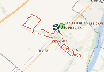

Length
9.6 km

Max alt
110 m

Uphill gradient
67 m
Km-Effort
10.5 km

Min alt
81 m

Downhill gradient
71 m
Boucle
Yes
Creation date :
2023-06-21 07:06:24.896
Updated on :
2023-06-21 09:51:39.284
2h15
Difficulty : Medium

FREE GPS app for hiking
 SityTrail
IGN / Geographical institutes
SityTrail Plus
The world is yours!
About
Trail Walking of 9.6 km to be discovered at Centre-Loire Valley, Loiret, Tavers. This trail is proposed by jcpinon.
Positioning
Country:
France
Region :
Centre-Loire Valley
Department/Province :
Loiret
Municipality :
Tavers
Location:
Unknown
Start:(Dec)
Start:(UTM)
395494 ; 5291090 (31T) N.
Comments