


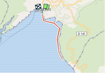
Cap Canaille depuis Cassis

ericberlin
User

Length
5.6 km

Max alt
8 m

Uphill gradient
25 m
Km-Effort
5.9 km

Min alt
-2 m

Downhill gradient
25 m
Boucle
Yes
Creation date :
2023-06-21 11:10:06.549
Updated on :
2023-06-21 11:13:49.822
3h00
Difficulty : Medium

FREE GPS app for hiking
 SityTrail
IGN / Geographical institutes
SityTrail Plus
The world is yours!
About
Trail Canoe - kayak of 5.6 km to be discovered at Provence-Alpes-Côte d'Azur, Bouches-du-Rhône, Cassis. This trail is proposed by ericberlin.
Photos

Positioning
Country:
France
Region :
Provence-Alpes-Côte d'Azur
Department/Province :
Bouches-du-Rhône
Municipality :
Cassis
Location:
Unknown
Start:(Dec)
Start:(UTM)
706168 ; 4787512 (31T) N.
Comments