


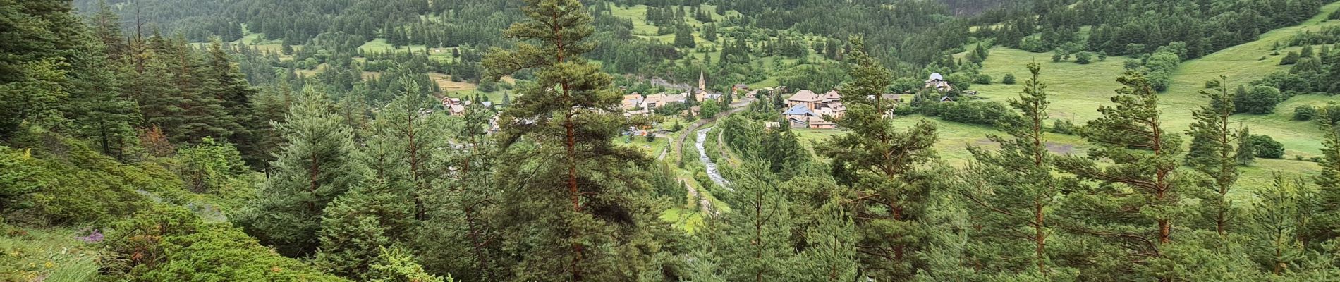
Queyras 10 - Aiguilles - Ville-Vieille

uru2010
User
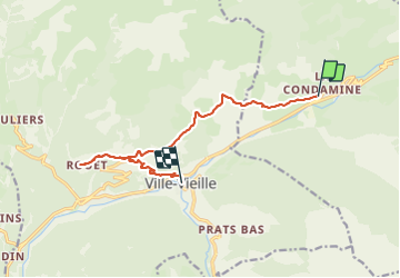

Length
11.8 km

Max alt
1805 m

Uphill gradient
457 m
Km-Effort
18.2 km

Min alt
1373 m

Downhill gradient
556 m
Boucle
No
Creation date :
2023-06-22 07:00:43.382
Updated on :
2023-06-22 14:53:44.238
4h40
Difficulty : Medium

FREE GPS app for hiking
 SityTrail
IGN / Geographical institutes
SityTrail Plus
The world is yours!
About
Trail Walking of 11.8 km to be discovered at Provence-Alpes-Côte d'Azur, Hautes-Alpes, Aiguilles. This trail is proposed by uru2010.
Photos


Positioning
Country:
France
Region :
Provence-Alpes-Côte d'Azur
Department/Province :
Hautes-Alpes
Municipality :
Aiguilles
Location:
Unknown
Start:(Dec)
Start:(UTM)
330953 ; 4960748 (32T) N.
Comments