


Chateldon_Bois_Noirs

jagarnier
User GUIDE
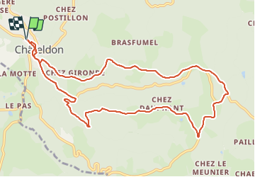

Length
11.7 km

Max alt
627 m

Uphill gradient
363 m
Km-Effort
16.6 km

Min alt
311 m

Downhill gradient
364 m
Boucle
Yes
Creation date :
2023-06-22 15:54:57.984
Updated on :
2023-06-24 09:36:30.573
3h30
Difficulty : Medium

FREE GPS app for hiking
 SityTrail
IGN / Geographical institutes
SityTrail Plus
The world is yours!
About
Trail Walking of 11.7 km to be discovered at Auvergne-Rhône-Alpes, Puy-de-Dôme, Châteldon. This trail is proposed by jagarnier.
Description
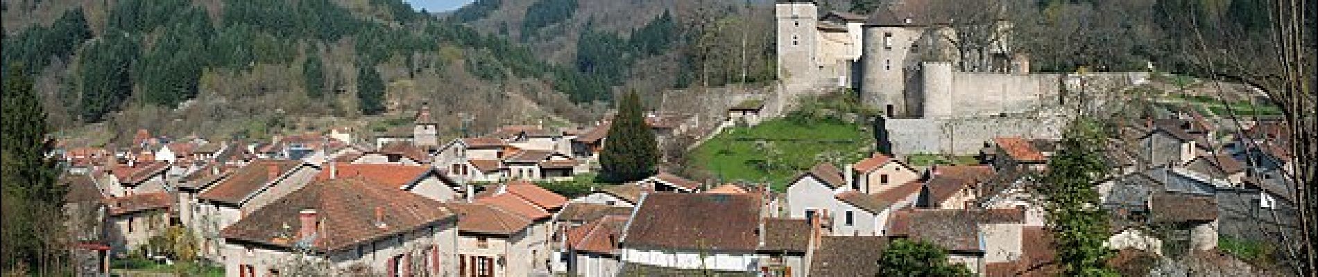
Circuit au départ de Châteldon, village comportant quelques belles maisons médiévales. Vous randonnerez sur les contreforts Nord du Livradois, appelés les Bois Noirs.
Photos

Positioning
Country:
France
Region :
Auvergne-Rhône-Alpes
Department/Province :
Puy-de-Dôme
Municipality :
Châteldon
Location:
Unknown
Start:(Dec)
Start:(UTM)
540104 ; 5091785 (31T) N.
Comments