


Esmoulières rando réelle

Sugg
User

Length
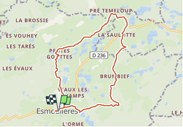
9.2 km

Max alt
656 m

Uphill gradient
171 m
Km-Effort
11.5 km

Min alt
540 m

Downhill gradient
170 m
Boucle
Yes
Creation date :
2023-06-22 12:16:42.934
Updated on :
2023-06-22 16:06:46.014
3h11
Difficulty : Medium

FREE GPS app for hiking
 SityTrail
IGN / Geographical institutes
SityTrail Plus
The world is yours!
About
Trail Walking of 9.2 km to be discovered at Bourgogne-Franche-Comté, Haute-Saône, Esmoulières. This trail is proposed by Sugg.
Description
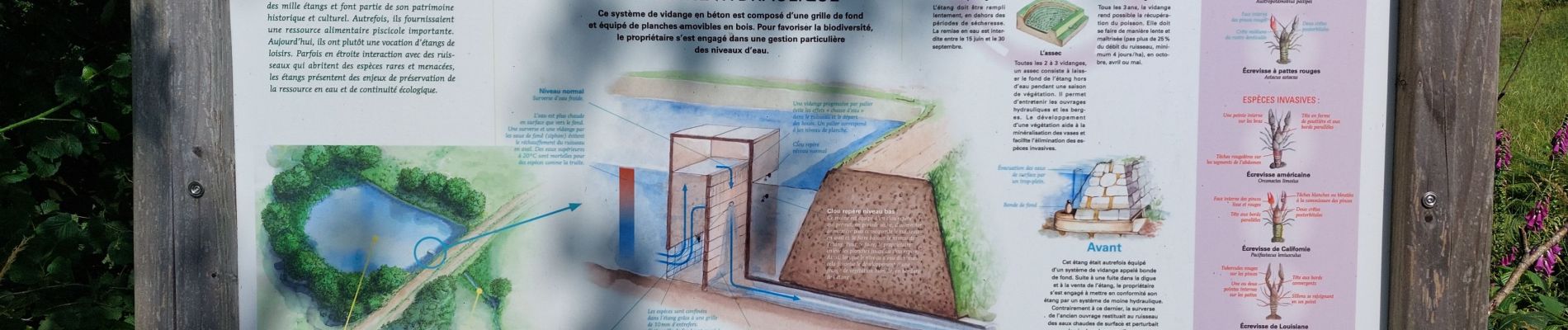
circuit balisé très intéressant et varié.
Photos


Positioning
Country:
France
Region :
Bourgogne-Franche-Comté
Department/Province :
Haute-Saône
Municipality :
Esmoulières
Location:
Unknown
Start:(Dec)
Start:(UTM)
321607 ; 5302639 (32T) N.
Comments