


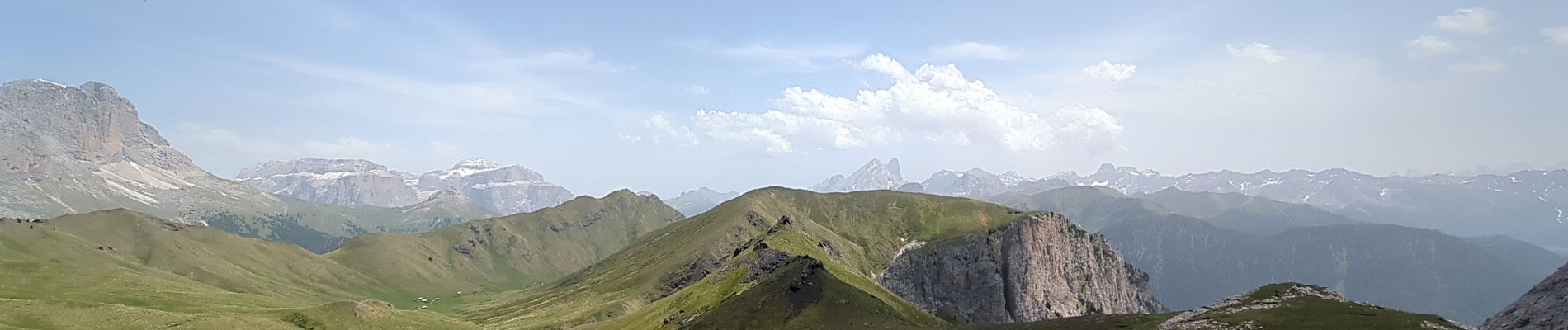
2 - Lago de Antermoia depuis Campitello Di Vassa

Noiraude
User
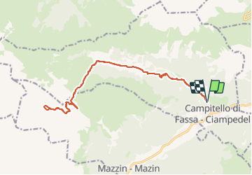

Length
20 km

Max alt
2538 m

Uphill gradient
1205 m
Km-Effort
36 km

Min alt
1483 m

Downhill gradient
1205 m
Boucle
Yes
Creation date :
2023-06-22 04:21:39.325
Updated on :
2023-06-23 12:10:02.157
7h59
Difficulty : Difficult

FREE GPS app for hiking
 SityTrail
IGN / Geographical institutes
SityTrail Plus
The world is yours!
About
Trail Walking of 20 km to be discovered at Trentino-Alto Adige/Südtirol, Provincia di Trento, Campitello di Fassa. This trail is proposed by Noiraude.
Photos


Positioning
Country:
Italy
Region :
Trentino-Alto Adige/Südtirol
Department/Province :
Provincia di Trento
Municipality :
Campitello di Fassa
Location:
Unknown
Start:(Dec)
Start:(UTM)
710243 ; 5151039 (32T) N.
Comments