


coq Arguille

lionelnottat
User
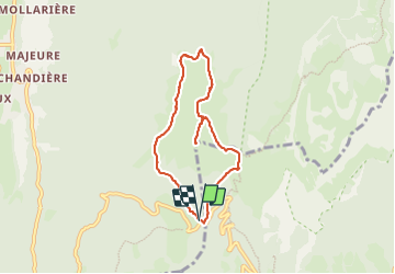

Length
6.7 km

Max alt
1769 m

Uphill gradient
406 m
Km-Effort
12.1 km

Min alt
1432 m

Downhill gradient
405 m
Boucle
Yes
Creation date :
2023-06-24 08:04:29.681
Updated on :
2023-06-24 12:43:44.298
2h25
Difficulty : Difficult

FREE GPS app for hiking
 SityTrail
IGN / Geographical institutes
SityTrail Plus
The world is yours!
About
Trail Walking of 6.7 km to be discovered at Auvergne-Rhône-Alpes, Isère, Saint-Pierre-de-Chartreuse. This trail is proposed by lionelnottat.
Positioning
Country:
France
Region :
Auvergne-Rhône-Alpes
Department/Province :
Isère
Municipality :
Saint-Pierre-de-Chartreuse
Location:
Unknown
Start:(Dec)
Start:(UTM)
722319 ; 5020513 (31T) N.
Comments