


lacs ste Anne et miroir

chrifor
User
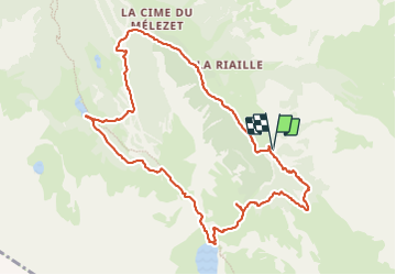

Length
11.2 km

Max alt
2411 m

Uphill gradient
560 m
Km-Effort
18.7 km

Min alt
1887 m

Downhill gradient
558 m
Boucle
Yes
Creation date :
2023-06-26 07:43:44.591
Updated on :
2023-06-26 15:51:13.803
4h30
Difficulty : Medium

FREE GPS app for hiking
 SityTrail
IGN / Geographical institutes
SityTrail Plus
The world is yours!
About
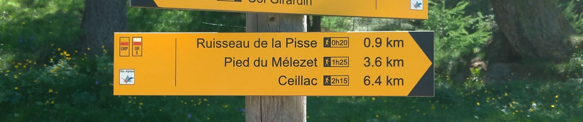
Trail Walking of 11.2 km to be discovered at Provence-Alpes-Côte d'Azur, Hautes-Alpes, Ceillac. This trail is proposed by chrifor.
Photos


Positioning
Country:
France
Region :
Provence-Alpes-Côte d'Azur
Department/Province :
Hautes-Alpes
Municipality :
Ceillac
Location:
Unknown
Start:(Dec)
Start:(UTM)
327222 ; 4944095 (32T) N.
Comments