


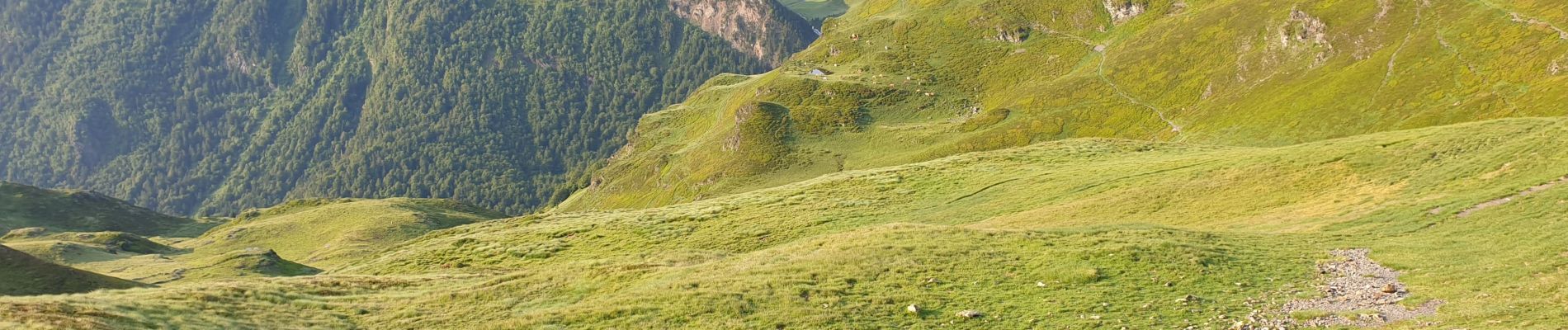
Retour voiture 28 juin 2023 hautacam

harydh
User GUIDE
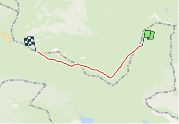

Length
3.9 km

Max alt
1980 m

Uphill gradient
34 m
Km-Effort
5.3 km

Min alt
1667 m

Downhill gradient
329 m
Boucle
No
Creation date :
2023-06-28 06:10:33.315
Updated on :
2023-07-03 10:34:44.141
1h41
Difficulty : Easy

FREE GPS app for hiking
 SityTrail
IGN / Geographical institutes
SityTrail Plus
The world is yours!
About
Trail Walking of 3.9 km to be discovered at Occitania, Hautespyrenees, Beaucens. This trail is proposed by harydh.
Photos


Positioning
Country:
France
Region :
Occitania
Department/Province :
Hautespyrenees
Municipality :
Beaucens
Location:
Unknown
Start:(Dec)
Start:(UTM)
258841 ; 4761744 (31T) N.
Comments