


Nevache Lac Vert

taguette
User
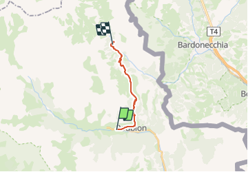

Length
12.7 km

Max alt
2198 m

Uphill gradient
730 m
Km-Effort
22 km

Min alt
1585 m

Downhill gradient
482 m
Boucle
No
Creation date :
2023-06-26 12:04:44.67
Updated on :
2023-06-28 09:05:17.819
4h39
Difficulty : Difficult

FREE GPS app for hiking
 SityTrail
IGN / Geographical institutes
SityTrail Plus
The world is yours!
About
Trail Walking of 12.7 km to be discovered at Provence-Alpes-Côte d'Azur, Hautes-Alpes, Névache. This trail is proposed by taguette.
Positioning
Country:
France
Region :
Provence-Alpes-Côte d'Azur
Department/Province :
Hautes-Alpes
Municipality :
Névache
Location:
Unknown
Start:(Dec)
Start:(UTM)
312277 ; 4987725 (32T) N.
Comments