


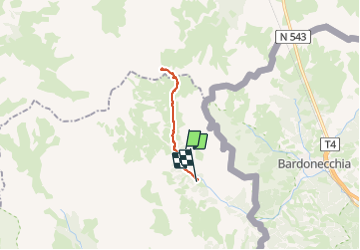
Lac vert refuges Thabor refg Terzo Alpini

taguette
User

Length
15.5 km

Max alt
2512 m

Uphill gradient
695 m
Km-Effort
25 km

Min alt
1760 m

Downhill gradient
761 m
Boucle
No
Creation date :
2023-06-27 06:26:47.612
Updated on :
2023-06-28 09:05:26.169
5h23
Difficulty : Difficult

FREE GPS app for hiking
 SityTrail
IGN / Geographical institutes
SityTrail Plus
The world is yours!
About
Trail Walking of 15.5 km to be discovered at Provence-Alpes-Côte d'Azur, Hautes-Alpes, Névache. This trail is proposed by taguette.
Positioning
Country:
France
Region :
Provence-Alpes-Côte d'Azur
Department/Province :
Hautes-Alpes
Municipality :
Névache
Location:
Unknown
Start:(Dec)
Start:(UTM)
312157 ; 4994452 (32T) N.
Comments