


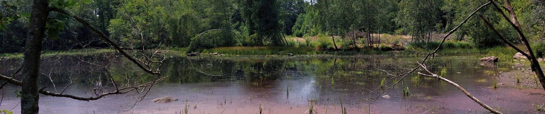
Étang de plate pierre

Sugg
User

Length
9.2 km

Max alt
491 m

Uphill gradient
161 m
Km-Effort
11.3 km

Min alt
437 m

Downhill gradient
163 m
Boucle
Yes
Creation date :
2023-06-29 08:29:03.809
Updated on :
2023-06-29 12:29:38.758
3h59
Difficulty : Medium

FREE GPS app for hiking
 SityTrail
IGN / Geographical institutes
SityTrail Plus
The world is yours!
About
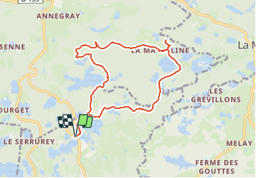
Trail Walking of 9.2 km to be discovered at Bourgogne-Franche-Comté, Haute-Saône, Écromagny. This trail is proposed by Sugg.
Description
rando réelle
Photos


Positioning
Country:
France
Region :
Bourgogne-Franche-Comté
Department/Province :
Haute-Saône
Municipality :
Écromagny
Location:
Unknown
Start:(Dec)
Start:(UTM)
317425 ; 5297097 (32T) N.
Comments