


Lac de Servières à partir du Café du Lac

Dalma Chuck
User
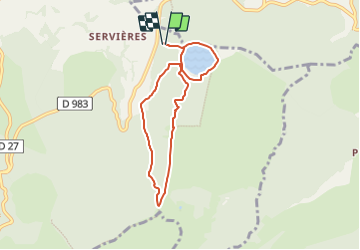

Length
6.6 km

Max alt
1378 m

Uphill gradient
211 m
Km-Effort
9.5 km

Min alt
1198 m

Downhill gradient
215 m
Boucle
Yes
Creation date :
2023-06-29 17:44:38.772
Updated on :
2023-06-30 19:41:14.457
2h09
Difficulty : Medium

FREE GPS app for hiking
 SityTrail
IGN / Geographical institutes
SityTrail Plus
The world is yours!
About
Trail Walking of 6.6 km to be discovered at Auvergne-Rhône-Alpes, Puy-de-Dôme, Orcival. This trail is proposed by Dalma Chuck.
Description
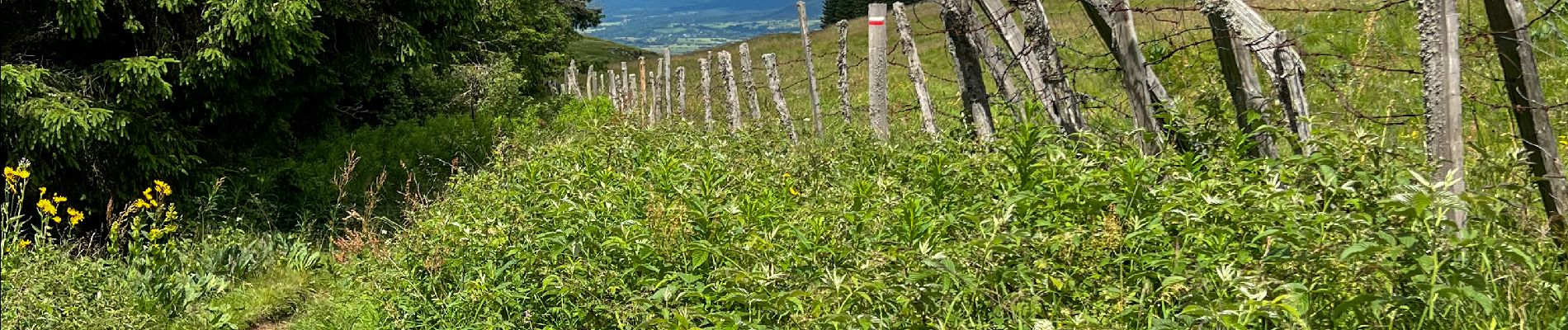
Belle rando dans la forêt et autour du lac de Servières. Descente par un sentier étroit. Sortie adaptée aux quatre pattes en bonne forme.
Photos


Positioning
Country:
France
Region :
Auvergne-Rhône-Alpes
Department/Province :
Puy-de-Dôme
Municipality :
Orcival
Location:
Unknown
Start:(Dec)
Start:(UTM)
488575 ; 5054919 (31T) N.
Comments