


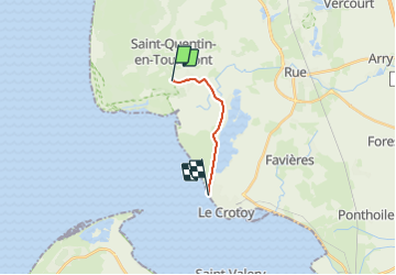
LP80_Marquenterre-LeCrotoy

GR77LP
User

Length
7.4 km

Max alt
13 m

Uphill gradient
25 m
Km-Effort
7.7 km

Min alt
2 m

Downhill gradient
29 m
Boucle
No
Creation date :
2023-06-30 13:41:31.973
Updated on :
2023-07-04 15:48:42.4
28m
Difficulty : Easy

FREE GPS app for hiking
 SityTrail
IGN / Geographical institutes
SityTrail Plus
The world is yours!
About
Trail Road bike of 7.4 km to be discovered at Hauts-de-France, Somme, Saint-Quentin-en-Tourmont. This trail is proposed by GR77LP.
Description
Par la nouvelle piste cyclable
Positioning
Country:
France
Region :
Hauts-de-France
Department/Province :
Somme
Municipality :
Saint-Quentin-en-Tourmont
Location:
Unknown
Start:(Dec)
Start:(UTM)
399538 ; 5569510 (31U) N.
Comments