


De Manosque à Castellane - jour 4 - De Saints Croix de Verdon a Moustiers Sainte Marie

mrcat
User
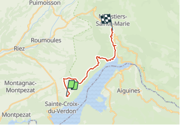

Length
17.3 km

Max alt
737 m

Uphill gradient
279 m
Km-Effort
21 km

Min alt
472 m

Downhill gradient
363 m
Boucle
No
Creation date :
2023-07-02 05:24:10.149
Updated on :
2023-07-02 14:19:36.066
4h33
Difficulty : Very difficult

FREE GPS app for hiking
 SityTrail
IGN / Geographical institutes
SityTrail Plus
The world is yours!
About
Trail Walking of 17.3 km to be discovered at Provence-Alpes-Côte d'Azur, Alpes-de-Haute-Provence, Sainte-Croix-du-Verdon. This trail is proposed by mrcat.
Positioning
Country:
France
Region :
Provence-Alpes-Côte d'Azur
Department/Province :
Alpes-de-Haute-Provence
Municipality :
Sainte-Croix-du-Verdon
Location:
Unknown
Start:(Dec)
Start:(UTM)
271230 ; 4850247 (32T) N.
Comments