


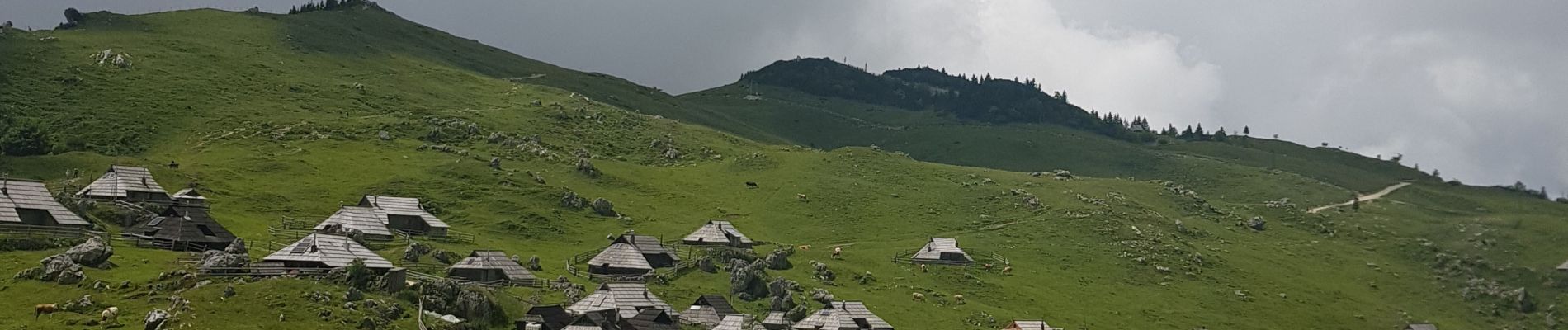
Velika Planina

christelVaissiere
User
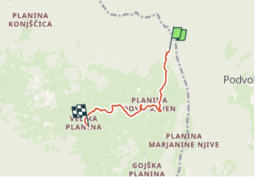

Length
3.8 km

Max alt
1557 m

Uphill gradient
178 m
Km-Effort
5.6 km

Min alt
1410 m

Downhill gradient
34 m
Boucle
No
Creation date :
2023-07-04 10:52:28.382
Updated on :
2023-07-04 12:04:05.086
1h10
Difficulty : Very easy

FREE GPS app for hiking
 SityTrail
IGN / Geographical institutes
SityTrail Plus
The world is yours!
About
Trail Walking of 3.8 km to be discovered at Unknown, Unknown, Kamnik. This trail is proposed by christelVaissiere.
Description
chemin du parking 3 au plateau de Velika Planina
Photos


Positioning
Country:
Slovenia
Region :
Unknown
Department/Province :
Unknown
Municipality :
Kamnik
Location:
Unknown
Start:(Dec)
Start:(UTM)
474815 ; 5128339 (33T) N.
Comments