


Couvent St Hubert

soca
User

Length
12.4 km

Max alt
506 m

Uphill gradient
521 m
Km-Effort
19.2 km

Min alt
152 m

Downhill gradient
487 m
Boucle
No
Creation date :
2015-03-25 00:00:00.0
Updated on :
2015-03-25 00:00:00.0
4h00
Difficulty : Easy

FREE GPS app for hiking
 SityTrail
IGN / Geographical institutes
SityTrail Plus
The world is yours!
About
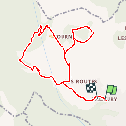
Trail Walking of 12.4 km to be discovered at Provence-Alpes-Côte d'Azur, Var, Solliès-Toucas. This trail is proposed by soca.
Positioning
Country:
France
Region :
Provence-Alpes-Côte d'Azur
Department/Province :
Var
Municipality :
Solliès-Toucas
Location:
Unknown
Start:(Dec)
Start:(UTM)
256292 ; 4787354 (32T) N.
Comments
Bon trace, mais à revoir à la source
attention à la source, plus de trace