


20230604

cmike39
User
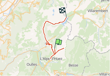

Length
57 km

Max alt
3301 m

Uphill gradient
4012 m
Km-Effort
112 km

Min alt
758 m

Downhill gradient
4290 m
Boucle
No
Creation date :
2023-07-05 08:34:19.03
Updated on :
2023-07-07 14:07:57.596
5h16
Difficulty : Very difficult

FREE GPS app for hiking
 SityTrail
IGN / Geographical institutes
SityTrail Plus
The world is yours!
About
Trail Walking of 57 km to be discovered at Auvergne-Rhône-Alpes, Isère, Oz. This trail is proposed by cmike39.
Positioning
Country:
France
Region :
Auvergne-Rhône-Alpes
Department/Province :
Isère
Municipality :
Oz
Location:
Unknown
Start:(Dec)
Start:(UTM)
270757 ; 5000833 (32T) N.
Comments