


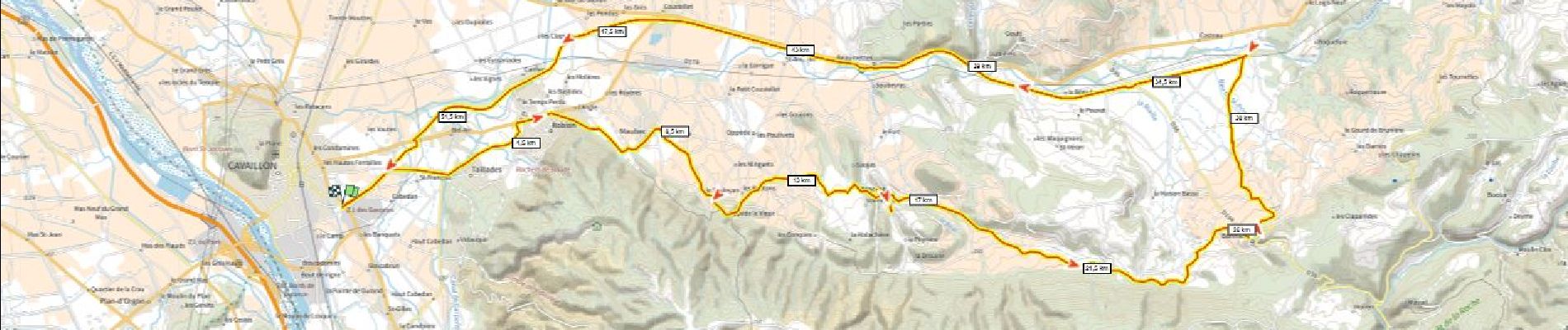
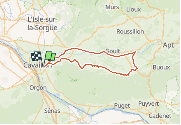
Cavaillon Bonnieux 670m+ par les villages retour par voie verte

ericberlin
User


3h51
Difficulty : Very difficult

FREE GPS app for hiking
 SityTrail
IGN / Geographical institutes
SityTrail Plus
The world is yours!
About
Trail Road bike of 55 km to be discovered at Provence-Alpes-Côte d'Azur, Vaucluse, Cavaillon. This trail is proposed by ericberlin.
Description
https://www.af3v.org/les-voies-vertes/carte-du-schema-national-des-veloroutes-et-voies-vertes/
https://www.af3v.org/les-voies-vertes/voies/107-ev8-mediterranee-a-velo-de-cavaillon-a-apt-veloroute-du-calavon/
https://www.veloloisirprovence.com/page/la-mediterranee-a-velo
https://www.veloloisirprovence.com/page/rando-vaucluse---de-robion-a-bonnieux--en-passant-par-les-villages-perches-du-luberon 11320.html
Photos

Positioning
Comments