


le Morgon par Les Ortals et les traverses

orsel
User GUIDE
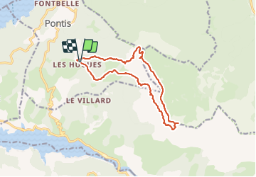

Length
14.8 km

Max alt
2349 m

Uphill gradient
1113 m
Km-Effort
30 km

Min alt
1454 m

Downhill gradient
1105 m
Boucle
Yes
Creation date :
2023-07-09 06:15:43.06
Updated on :
2023-07-09 16:17:55.892
10h00
Difficulty : Difficult

FREE GPS app for hiking
 SityTrail
IGN / Geographical institutes
SityTrail Plus
The world is yours!
About
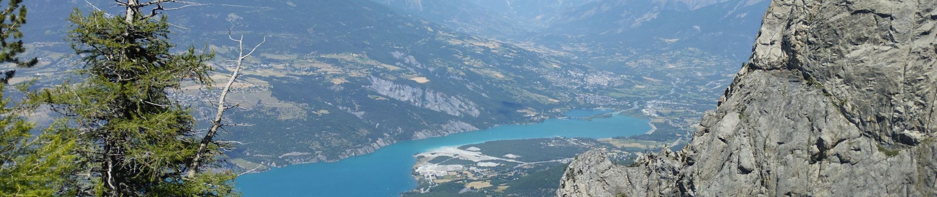
Trail Walking of 14.8 km to be discovered at Provence-Alpes-Côte d'Azur, Alpes-de-Haute-Provence, Pontis. This trail is proposed by orsel.
Photos

Positioning
Country:
France
Region :
Provence-Alpes-Côte d'Azur
Department/Province :
Alpes-de-Haute-Provence
Municipality :
Pontis
Location:
Unknown
Start:(Dec)
Start:(UTM)
290748 ; 4929719 (32T) N.
Comments