


sf10_e5b

My Switzerland
Optez pour le retour à la nature GUIDE+
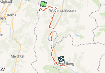

Length
19.6 km

Max alt
1404 m

Uphill gradient
829 m
Km-Effort
32 km

Min alt
550 m

Downhill gradient
1227 m
Boucle
No
Creation date :
2014-12-10 00:00:00.0
Updated on :
2014-12-10 00:00:00.0
7h30
Difficulty : Unknown

FREE GPS app for hiking
 SityTrail
IGN / Geographical institutes
SityTrail Plus
The world is yours!
About
Trail Other activity of 19.6 km to be discovered at Nidwalden, Unknown, Dallenwil. This trail is proposed by My Switzerland.


Positioning
Country:
Switzerland
Region :
Nidwalden
Department/Province :
Unknown
Municipality :
Dallenwil
Location:
Unknown
Start:(Dec)
Start:(UTM)
449851 ; 5195165 (32T) N.
Comments