


Lacs Du Néouvielle par le Col d’Estoudou

lebarça
User
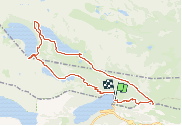

Length
12 km

Max alt
2239 m

Uphill gradient
538 m
Km-Effort
19.1 km

Min alt
1852 m

Downhill gradient
524 m
Boucle
Yes
Creation date :
2023-07-15 07:45:05.0
Updated on :
2023-07-15 13:55:03.889
6h07
Difficulty : Medium

FREE GPS app for hiking
 SityTrail
IGN / Geographical institutes
SityTrail Plus
The world is yours!
About
Trail Walking of 12 km to be discovered at Occitania, Hautespyrenees, Saint-Lary-Soulan. This trail is proposed by lebarça.
Positioning
Country:
France
Region :
Occitania
Department/Province :
Hautespyrenees
Municipality :
Saint-Lary-Soulan
Location:
Unknown
Start:(Dec)
Start:(UTM)
268646 ; 4745595 (31T) N.
Comments