


Bucey180720213

FPortier
User

Length
8.7 km

Max alt
306 m

Uphill gradient
232 m
Km-Effort
11.8 km

Min alt
190 m

Downhill gradient
232 m
Boucle
Yes
Creation date :
2023-07-15 19:13:32.159
Updated on :
2023-07-18 05:48:04.271
2h40
Difficulty : Medium

FREE GPS app for hiking
 SityTrail
IGN / Geographical institutes
SityTrail Plus
The world is yours!
About
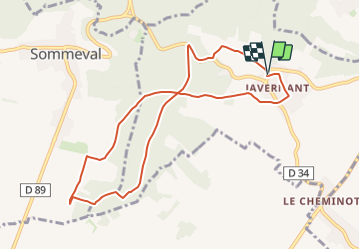
Trail Walking of 8.7 km to be discovered at Grand Est, Aube, Javernant. This trail is proposed by FPortier.
Positioning
Country:
France
Region :
Grand Est
Department/Province :
Aube
Municipality :
Javernant
Location:
Unknown
Start:(Dec)
Start:(UTM)
574448 ; 5334794 (31U) N.
Comments