Trail Walking Lanuéjols - Circuit autour d'Aiguebonne - Photo

Circuit autour d'Aiguebonne

 piem
piem

User

© OpenStreetMap contributors
Length
Length
17 km
Max alt
Max alt
939 m
Uphill gradient
Uphill gradient
668 m
Km-Effort
Km-Effort  
26 km
Min alt
Min alt
578 m
Downhill gradient
Downhill gradient
668 m
Boucle
Boucle
Yes
Creation date :
2023-07-16 12:50:21.807
Updated on :
2023-07-16 12:52:01.325

(0 Reviews)

Walking
Walking
5h53
Difficulty : Very difficult

Scan this QR Code to open this trail in the SityTrail application

FREE GPS app for hiking

Logo SityTrail SityTrail

IGN / Geographical institutes

Download SityTrail from the App Store Download SityTrail from Google Play

Logo SityTrail SityTrail World

The world is yours!

Download SityTrail from the App Store Download SityTrail from Google Play Download SityTrail on Huawei AppGallery

About

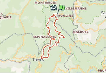
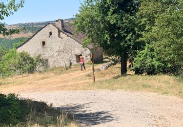
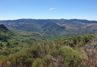
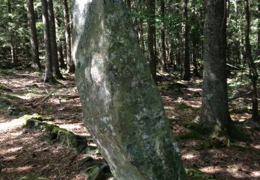
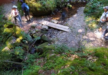
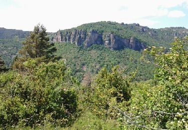
Trail Walking of 17 km to be discovered at Occitania, Gard, Lanuéjols. This trail is proposed by piem.

Description

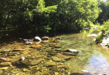
Circuit avec un très beau site de baignade dans la Valat de la Cabane

Elevation profile

Positioning

Country:
France
Region :
Occitania
Department/Province :
Gard
Municipality :
Lanuéjols
Location:
Unknown
Start:(UTM)
532962 ; 4884799 (31T) N.

Trails nearby

Trail Walking Trèves - st firmin - Photo
Walking
aldeu

Walking

Medium
(1)
Trèves, Occitania, Gard, France
6.9 km | 11.9 km-effort
2h 38min
Yes
Trail Walking Lanuéjols - Boucle Lanuejols - Pont de Claperousse - Photo
Walking
LBarel

Walking

Very easy
Lanuéjols, Occitania, Gard, France
7.4 km | 9.2 km-effort
2h 0min
Yes
Trail Walking Lanuéjols - Commeiras - Photo
Walking
boudpn

Walking

Lanuéjols, Occitania, Gard, France
16.3 km | 24 km-effort
6h 23min
Yes
Trail On foot Lanuéjols - gorges du Trevezel Gard GPS - Photo
On foot
silvestreclaudine

On foot

Medium
Lanuéjols, Occitania, Gard, France
18.7 km | 30 km-effort
Unknown
Yes
Trail Walking Trèves - trevezel in live - Photo
Walking
CASSISFRAMBOISE

Walking

Very difficult
Trèves, Occitania, Gard, France
17.6 km | 30 km-effort
4h 51min
Yes
Trail On foot Saint-Sauveur-Camprieu - GR 66A - Photo
On foot
PRO

On foot

Easy
Saint-Sauveur-Camprieu, Occitania, Gard, France
10.6 km | 14.3 km-effort
3h 14min
No
Trail Walking Dourbies - Comeiras- Canayere  - Photo
Walking
gege30

Walking

Medium
Dourbies, Occitania, Gard, France
10.9 km | 15.6 km-effort
2h 34min
Yes
Trail Walking Meyrueis - la croix de fer  - Photo
Walking
Erickcausse

Walking

Medium
Meyrueis, Occitania, Lozère, France
18.8 km | 26 km-effort
3h 49min
Yes
Trail Walking Trèves - Treves gte st Firmin Comeiras - Photo
Walking
JEANJOSY

Walking

Medium
Trèves, Occitania, Gard, France
18.5 km | 31 km-effort
5h 41min
Yes


Close
My subscriptions