Trail Bicycle tourism Rethel - Balade Ardennaise Voie Verte - Photo

Balade Ardennaise Voie Verte

© OpenStreetMap contributors
Length
Length
183 km
Max alt
Max alt
215 m
Uphill gradient
Uphill gradient
1742 m
Km-Effort
Km-Effort  
206 km
Min alt
Min alt
70 m
Downhill gradient
Downhill gradient
1713 m
Boucle
Boucle
No
Creation date :
2023-07-14 06:58:08.888
Updated on :
2023-07-16 13:20:01.048

(0 Reviews)

Bicycle tourism
Bicycle tourism
17h23
Difficulty : Medium

Scan this QR Code to open this trail in the SityTrail application

FREE GPS app for hiking

Logo SityTrail SityTrail

IGN / Geographical institutes

Download SityTrail from the App Store Download SityTrail from Google Play

Logo SityTrail SityTrail World

The world is yours!

Download SityTrail from the App Store Download SityTrail from Google Play Download SityTrail on Huawei AppGallery

About

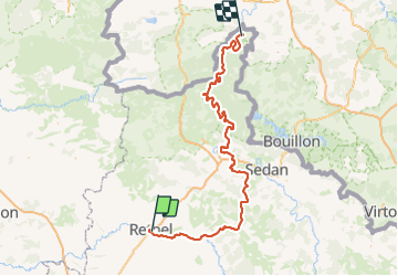
Trail Bicycle tourism of 183 km to be discovered at Grand Est, Ardennes, Rethel. This trail is proposed by ThierryLECLERC.

Description

Voie verte au coeur des Ardennes

Elevation profile

Positioning

Country:
France
Region :
Grand Est
Department/Province :
Ardennes
Municipality :
Rethel
Location:
Rethel
Start:(UTM)
599229 ; 5484522 (31U) N.

Trails nearby

Trail Other activity Barby - barby signy l'abbaye - Photo
Other activity
8pascal8

Other activity

Very easy
Barby, Grand Est, Ardennes, France
30 km | 37 km-effort
Unknown
No
Trail Road bike Acy-Romance - Acy Romance. Semuy - Photo
Road bike
ThierryLECLERC

Road bike

Easy
Acy-Romance, Grand Est, Ardennes, France
53 km | 58 km-effort
3h 17min
Yes


Close
My subscriptions