


col de la porte et de la Dole

fizz1212
User
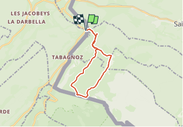

Length
11.4 km

Max alt
1671 m

Uphill gradient
594 m
Km-Effort
19.4 km

Min alt
1233 m

Downhill gradient
594 m
Boucle
Yes
Creation date :
2023-07-17 10:15:30.293
Updated on :
2023-07-17 14:54:12.141
3h54
Difficulty : Very difficult

FREE GPS app for hiking
 SityTrail
IGN / Geographical institutes
SityTrail Plus
The world is yours!
About
Trail Walking of 11.4 km to be discovered at Bourgogne-Franche-Comté, Jura, Prémanon. This trail is proposed by fizz1212.
Description
600 mètres de dénivelé positif.
col de la porte et de la Dole par les crêtes.
Photos


Positioning
Country:
France
Region :
Bourgogne-Franche-Comté
Department/Province :
Jura
Municipality :
Prémanon
Location:
Unknown
Start:(Dec)
Start:(UTM)
276134 ; 5147390 (32T) N.
Comments