


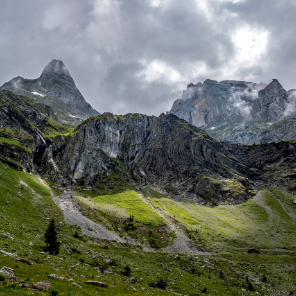
Itinéraire en bord de Dranse de la Chapelle à Abondance
Les Portes du Soleil
Parcours Randos, VTT-AE et Trail Running en été
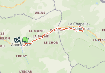

Length
15.6 km

Max alt
1028 m

Uphill gradient
171 m
Km-Effort
17.9 km

Min alt
919 m

Downhill gradient
171 m
Boucle
Yes
Creation date :
2023-07-18 12:29:31.526
Updated on :
2023-07-18 12:29:31.526
4h04
Difficulty : Easy

FREE GPS app for hiking
 SityTrail
IGN / Geographical institutes
SityTrail Plus
The world is yours!
About
Trail On foot of 15.6 km to be discovered at Auvergne-Rhône-Alpes, Upper Savoy, Abondance. This trail is proposed by Les Portes du Soleil.
Positioning
Country:
France
Region :
Auvergne-Rhône-Alpes
Department/Province :
Upper Savoy
Municipality :
Abondance
Location:
Unknown
Start:(Dec)
Start:(UTM)
324372 ; 5127603 (32T) N.
Comments