


20230719 Bihit Trebeurden

Childebert
User
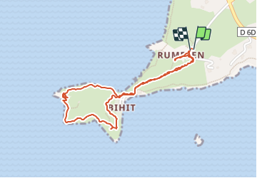

Length
2.2 km

Max alt
63 m

Uphill gradient
70 m
Km-Effort
3.1 km

Min alt
4 m

Downhill gradient
72 m
Boucle
Yes
Creation date :
2023-07-19 11:41:07.322
Updated on :
2023-07-19 15:18:14.497
42m
Difficulty : Easy

FREE GPS app for hiking
 SityTrail
IGN / Geographical institutes
SityTrail Plus
The world is yours!
About
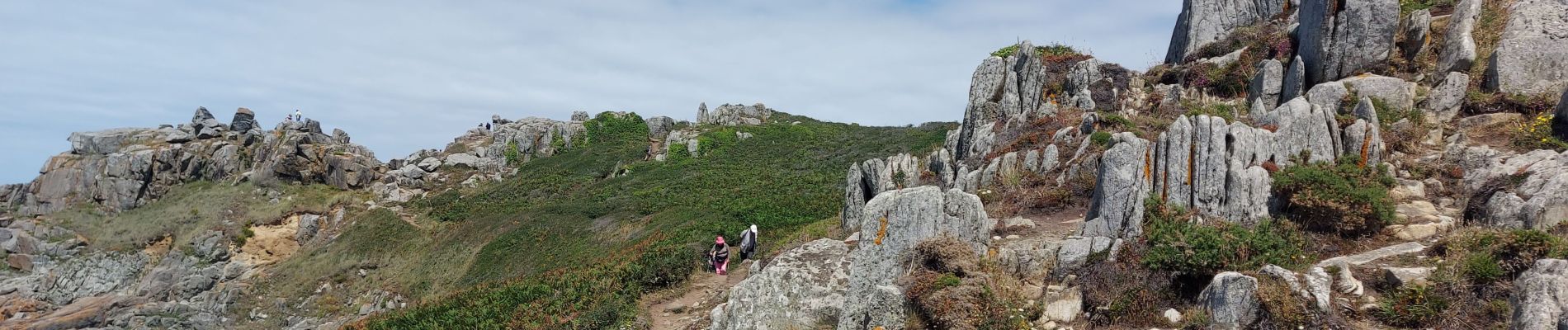
Trail Walking of 2.2 km to be discovered at Brittany, Côtes-d'Armor, Trébeurden. This trail is proposed by Childebert.
Photos

Positioning
Country:
France
Region :
Brittany
Department/Province :
Côtes-d'Armor
Municipality :
Trébeurden
Location:
Unknown
Start:(Dec)
Start:(UTM)
457596 ; 5400981 (30U) N.
Comments