


le_bambois_20km-8078772-1689800036-603

Sefi78
User
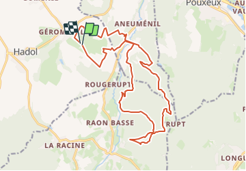

Length
20 km

Max alt
580 m

Uphill gradient
586 m
Km-Effort
28 km

Min alt
374 m

Downhill gradient
590 m
Boucle
Yes
Creation date :
2023-07-19 20:54:46.623
Updated on :
2023-07-19 21:07:11.843
--
Difficulty : Very easy

FREE GPS app for hiking
 SityTrail
IGN / Geographical institutes
SityTrail Plus
The world is yours!
About
Trail Equestrian of 20 km to be discovered at Grand Est, Vosges, Hadol. This trail is proposed by Sefi78.
Description
Balisage 29 bleu
Positioning
Country:
France
Region :
Grand Est
Department/Province :
Vosges
Municipality :
Hadol
Location:
Unknown
Start:(Dec)
Start:(UTM)
314364 ; 5329719 (32U) N.
Comments