


Le grand Veymont

Massiac15
User

Length
18.4 km

Max alt
2329 m

Uphill gradient
1471 m
Km-Effort
38 km

Min alt
1131 m

Downhill gradient
1470 m
Boucle
Yes
Creation date :
2023-07-20 05:23:22.0
Updated on :
2023-07-20 15:55:53.217
8h32
Difficulty : Very difficult

FREE GPS app for hiking
 SityTrail
IGN / Geographical institutes
SityTrail Plus
The world is yours!
About
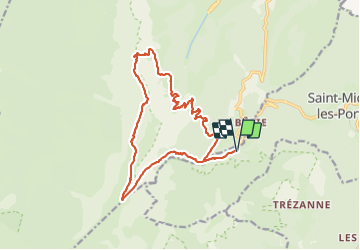
Trail Walking of 18.4 km to be discovered at Auvergne-Rhône-Alpes, Isère, Saint-Michel-les-Portes. This trail is proposed by Massiac15.
Positioning
Country:
France
Region :
Auvergne-Rhône-Alpes
Department/Province :
Isère
Municipality :
Saint-Michel-les-Portes
Location:
Unknown
Start:(Dec)
Start:(UTM)
702078 ; 4970356 (31T) N.
Comments