


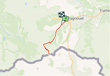
Barroude

chasle
User

Length
21 km

Max alt
2534 m

Uphill gradient
1152 m
Km-Effort
37 km

Min alt
1384 m

Downhill gradient
1275 m
Boucle
No
Creation date :
2023-07-20 05:53:50.183
Updated on :
2023-07-20 16:59:26.596
5h42
Difficulty : Difficult

FREE GPS app for hiking
 SityTrail
IGN / Geographical institutes
SityTrail Plus
The world is yours!
About
Trail Walking of 21 km to be discovered at Occitania, Hautespyrenees, Aragnouet. This trail is proposed by chasle.
Positioning
Country:
France
Region :
Occitania
Department/Province :
Hautespyrenees
Municipality :
Aragnouet
Location:
Unknown
Start:(Dec)
Start:(UTM)
269112 ; 4739430 (31T) N.
Comments