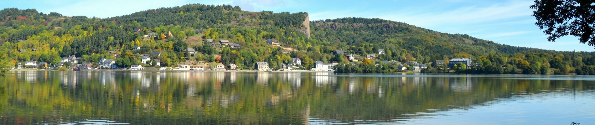
Beaune_Lac_Chambon

jagarnier
User GUIDE
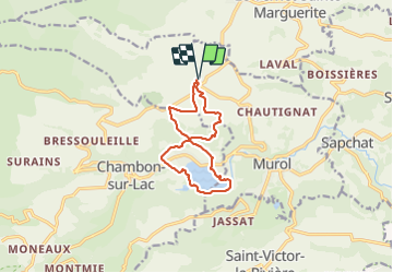

Length
10.8 km

Max alt
1088 m

Uphill gradient
359 m
Km-Effort
15.6 km

Min alt
872 m

Downhill gradient
360 m
Boucle
Yes
Creation date :
2023-07-27 05:57:57.088
Updated on :
2023-07-30 06:39:17.693
3h15
Difficulty : Medium

FREE GPS app for hiking
 SityTrail
IGN / Geographical institutes
SityTrail Plus
The world is yours!
About
Trail Walking of 10.8 km to be discovered at Auvergne-Rhône-Alpes, Puy-de-Dôme, Murol. This trail is proposed by jagarnier.
Photos

Positioning
Country:
France
Region :
Auvergne-Rhône-Alpes
Department/Province :
Puy-de-Dôme
Municipality :
Murol
Location:
Unknown
Start:(Dec)
Start:(UTM)
493711 ; 5048769 (31T) N.
Comments