


Lac Autier depuis le Countet

GOHIER
User
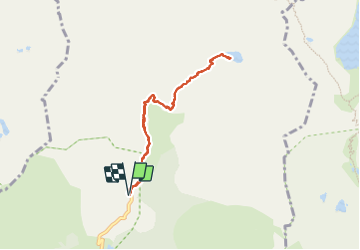

Length
7.8 km

Max alt
2272 m

Uphill gradient
583 m
Km-Effort
15.6 km

Min alt
1685 m

Downhill gradient
591 m
Boucle
Yes
Creation date :
2023-07-14 06:56:42.0
Updated on :
2023-07-27 07:25:25.734
5h48
Difficulty : Medium

FREE GPS app for hiking
 SityTrail
IGN / Geographical institutes
SityTrail Plus
The world is yours!
About
Trail Walking of 7.8 km to be discovered at Provence-Alpes-Côte d'Azur, Maritime Alps, Belvédère. This trail is proposed by GOHIER.
Description
Baignade mémorable dans le torrent.
Positioning
Country:
France
Region :
Provence-Alpes-Côte d'Azur
Department/Province :
Maritime Alps
Municipality :
Belvédère
Location:
Unknown
Start:(Dec)
Start:(UTM)
371829 ; 4881242 (32T) N.
Comments