


Col d'Arouste

sdroneau
User

Length
15.6 km

Max alt
2462 m

Uphill gradient
1324 m
Km-Effort
33 km

Min alt
1400 m

Downhill gradient
1321 m
Boucle
Yes
Creation date :
2023-07-27 05:59:57.432
Updated on :
2023-07-27 12:40:21.771
5h25
Difficulty : Very difficult

FREE GPS app for hiking
 SityTrail
IGN / Geographical institutes
SityTrail Plus
The world is yours!
About
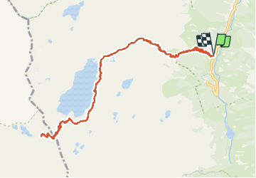
Trail Walking of 15.6 km to be discovered at Occitania, Hautespyrenees, Arrens-Marsous. This trail is proposed by sdroneau.
Positioning
Country:
France
Region :
Occitania
Department/Province :
Hautespyrenees
Municipality :
Arrens-Marsous
Location:
Unknown
Start:(Dec)
Start:(UTM)
722807 ; 4752190 (30T) N.
Comments