


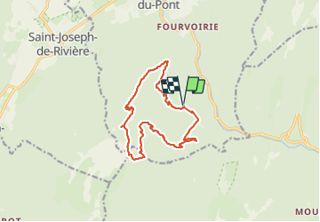
Crête des Charmilles - Pas de la Biche

GOHIER
User

Length
14.9 km

Max alt
1657 m

Uphill gradient
1014 m
Km-Effort
28 km

Min alt
849 m

Downhill gradient
1013 m
Boucle
Yes
Creation date :
2023-07-27 07:27:11.0
Updated on :
2023-07-27 14:12:15.621
6h32
Difficulty : Difficult

FREE GPS app for hiking
 SityTrail
IGN / Geographical institutes
SityTrail Plus
The world is yours!
About
Trail Walking of 14.9 km to be discovered at Auvergne-Rhône-Alpes, Isère, Saint-Laurent-du-Pont. This trail is proposed by GOHIER.
Description
Avec Jean-Louis et Patou
Positioning
Country:
France
Region :
Auvergne-Rhône-Alpes
Department/Province :
Isère
Municipality :
Saint-Laurent-du-Pont
Location:
Unknown
Start:(Dec)
Start:(UTM)
714931 ; 5026407 (31T) N.
Comments