Trail Walking Saint-Michel-Chef-Chef - Comberge - Photo
© OpenStreetMap contributors
Length
Length
18.3 km
Max alt
Max alt
48 m
Uphill gradient
Uphill gradient
157 m
Km-Effort
Km-Effort  
20 km
Min alt
Min alt
2 m
Downhill gradient
Downhill gradient
157 m
Boucle
Boucle
Yes
Creation date :
2015-01-04 00:00:00.0
Updated on :
2015-01-04 00:00:00.0

(0 Reviews)

Walking
Walking
5h00
Difficulty : Easy

Scan this QR Code to open this trail in the SityTrail application

FREE GPS app for hiking

Logo SityTrail SityTrail

IGN / Geographical institutes

Download SityTrail from the App Store Download SityTrail from Google Play

Logo SityTrail SityTrail World

The world is yours!

Download SityTrail from the App Store Download SityTrail from Google Play Download SityTrail on Huawei AppGallery

About

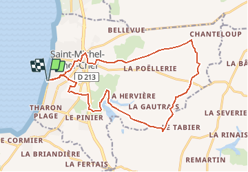
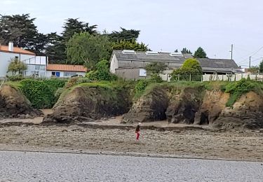
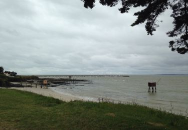
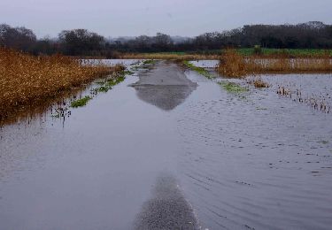
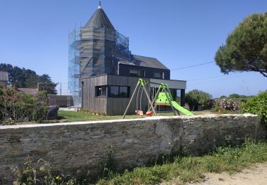
Trail Walking of 18.3 km to be discovered at Pays de la Loire, Loire-Atlantique, Saint-Michel-Chef-Chef. This trail is proposed by neoroll44.

Description

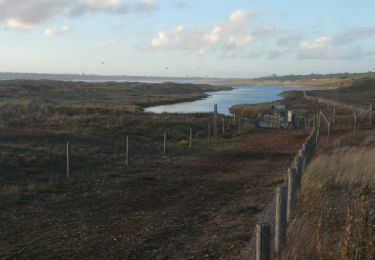
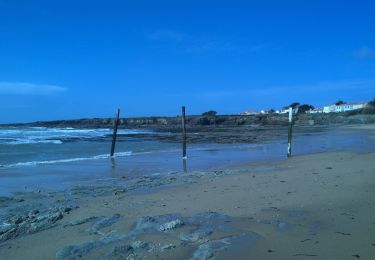
Du port de Comberge aux éoliennes et l'étang des Gâtineaux.

Elevation profile

Points of interest

Point of interest Saint-Michel-Chef-Chef - Etang des Gâtineaux - Photo
neoroll44
SAINT-MICHEL-CHEF-CHEF 

Positioning

Country:
France
Region :
Pays de la Loire
Department/Province :
Loire-Atlantique
Municipality :
Saint-Michel-Chef-Chef
Location:
Unknown
Start:(UTM)
563330 ; 5224884 (30T) N.

Trails nearby

Trail On foot Saint-Brevin-les-Pins - Circuit du Boivre - Photo
On foot
PRO

On foot

Easy
Saint-Brevin-les-Pins, Pays de la Loire, Loire-Atlantique, France
12.9 km | 14.3 km-effort
3h 14min
Yes
Trail On foot Préfailles - Pointe Saint-Gildas - Photo
On foot
PRO

On foot

Easy
Préfailles, Pays de la Loire, Loire-Atlantique, France
7.3 km | 8 km-effort
1h 49min
Yes
Trail Walking La Plaine-sur-Mer - La plaine sur Mer - Pornic - Photo
Walking
Lobin

Walking

Medium
La Plaine-sur-Mer, Pays de la Loire, Loire-Atlantique, France
20 km | 22 km-effort
3h 59min
No
Trail Walking La Plaine-sur-Mer - pornichet - Photo
Walking
pistou

Walking

Very easy
La Plaine-sur-Mer, Pays de la Loire, Loire-Atlantique, France
58 km | 63 km-effort
4h 26min
No
Trail Other activity La Plaine-sur-Mer - côte des moutons  - Photo
Other activity
bernardb2

Other activity

Easy
La Plaine-sur-Mer, Pays de la Loire, Loire-Atlantique, France
13 km | 14 km-effort
3h 32min
Yes
Trail Walking Saint-Brevin-les-Pins - boivre - Photo
Walking
neoroll44

Walking

Easy
Saint-Brevin-les-Pins, Pays de la Loire, Loire-Atlantique, France
10.6 km | 11.8 km-effort
2h 40min
Yes
Trail Mountain bike La Plaine-sur-Mer - La Plaine Eric 3 - Photo
Mountain bike
pln

Mountain bike

Medium
La Plaine-sur-Mer, Pays de la Loire, Loire-Atlantique, France
31 km | 35 km-effort
2h 7min
Yes
Trail Walking Saint-Michel-Chef-Chef - 2023-06-03 st Michel chef chef circuit littoral et moulins  - Photo
Walking
jacq58

Walking

Difficult
Saint-Michel-Chef-Chef, Pays de la Loire, Loire-Atlantique, France
15.7 km | 17.2 km-effort
3h 20min
No
Trail Walking Saint-Michel-Chef-Chef - Saint-Michel-Chef-Chef Randonnée - Photo
Walking
LeonEvain

Walking

Difficult
Saint-Michel-Chef-Chef, Pays de la Loire, Loire-Atlantique, France
11.2 km | 12.7 km-effort
2h 53min
Yes


Close
My subscriptions