SOLUTRÉ-POUILLY - Roche de Vergisson et roche de Solutré.

AndreLACOMBE
User
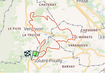

Length
10.9 km

Max alt
476 m

Uphill gradient
507 m
Km-Effort
17.7 km

Min alt
227 m

Downhill gradient
507 m
Boucle
Yes
Creation date :
2023-07-28 12:51:34.554
Updated on :
2023-07-28 12:59:28.305
4h01
Difficulty : Difficult

FREE GPS app for hiking
 SityTrail
IGN / Geographical institutes
SityTrail Plus
The world is yours!
About
Trail Walking of 10.9 km to be discovered at Bourgogne-Franche-Comté, Saône-et-Loire, Solutré-Pouilly. This trail is proposed by AndreLACOMBE.
Description
Boucle au départ du parking sur D5 à proximité de Solutré-Pouilly.
Positioning
Country:
France
Region :
Bourgogne-Franche-Comté
Department/Province :
Saône-et-Loire
Municipality :
Solutré-Pouilly
Location:
Unknown
Start:(Dec)
Start:(UTM)
632085 ; 5128478 (31T) N.
Comments