


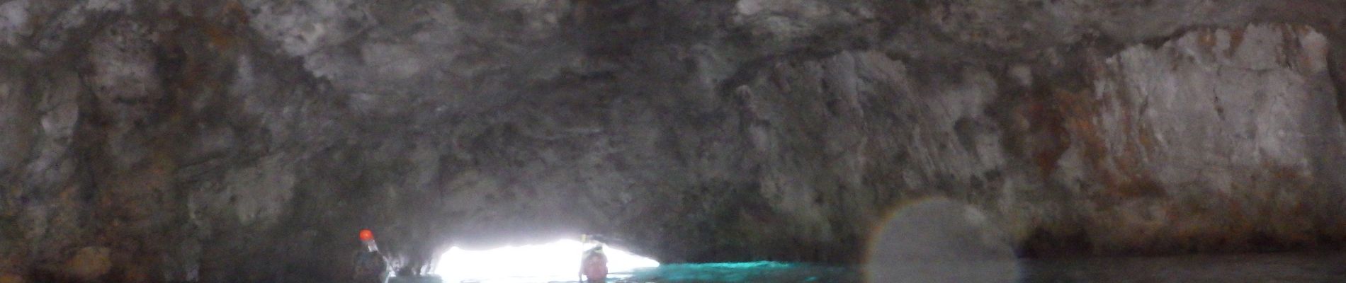
Grotte bleue

fhascoet
User
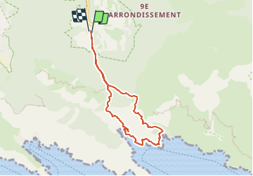

Length
7.3 km

Max alt
217 m

Uphill gradient
279 m
Km-Effort
11 km

Min alt
-6 m

Downhill gradient
282 m
Boucle
Yes
Creation date :
2023-07-28 16:10:12.968
Updated on :
2023-07-30 11:09:08.03
2h30
Difficulty : Medium

FREE GPS app for hiking
 SityTrail
IGN / Geographical institutes
SityTrail Plus
The world is yours!
About
Trail Walking of 7.3 km to be discovered at Provence-Alpes-Côte d'Azur, Bouches-du-Rhône, Marseille. This trail is proposed by fhascoet.
Description
Accès 200m à la nage retour par La calanque de Sujiton
Photos

Positioning
Country:
France
Region :
Provence-Alpes-Côte d'Azur
Department/Province :
Bouches-du-Rhône
Municipality :
Marseille
Location:
9th Arrondissement
Start:(Dec)
Start:(UTM)
697897 ; 4789232 (31T) N.
Comments