


LASSERE-PRADERE rando nocturne

chrisgps
User
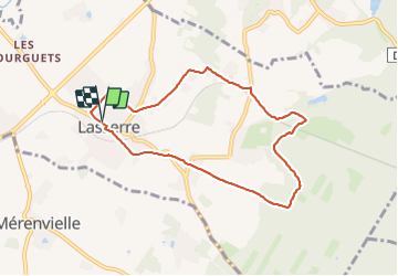

Length
8 km

Max alt
248 m

Uphill gradient
119 m
Km-Effort
9.6 km

Min alt
156 m

Downhill gradient
118 m
Boucle
Yes
Creation date :
2023-07-28 19:06:33.757
Updated on :
2023-07-29 14:13:35.274
2h11
Difficulty : Medium

FREE GPS app for hiking
 SityTrail
IGN / Geographical institutes
SityTrail Plus
The world is yours!
About
Trail Walking of 8 km to be discovered at Occitania, Haute-Garonne, Lasserre-Pradère. This trail is proposed by chrisgps.
Photos


Positioning
Country:
France
Region :
Occitania
Department/Province :
Haute-Garonne
Municipality :
Lasserre-Pradère
Location:
Unknown
Start:(Dec)
Start:(UTM)
352222 ; 4833430 (31T) N.
Comments