


Génicourt / Vavincourt

flzanichelli
User
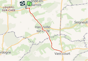

Length
13.4 km

Max alt
278 m

Uphill gradient
140 m
Km-Effort
15.3 km

Min alt
206 m

Downhill gradient
140 m
Boucle
Yes
Creation date :
2023-07-29 08:32:34.253
Updated on :
2023-07-29 09:01:07.118
23m
Difficulty : Very easy

FREE GPS app for hiking
 SityTrail
IGN / Geographical institutes
SityTrail Plus
The world is yours!
About
Trail Other activity of 13.4 km to be discovered at Grand Est, Meuse, Les Hauts-de-Chée. This trail is proposed by flzanichelli.
Description
balade
Positioning
Country:
France
Region :
Grand Est
Department/Province :
Meuse
Municipality :
Les Hauts-de-Chée
Location:
Unknown
Start:(Dec)
Start:(UTM)
658258 ; 5414624 (31U) N.
Comments