


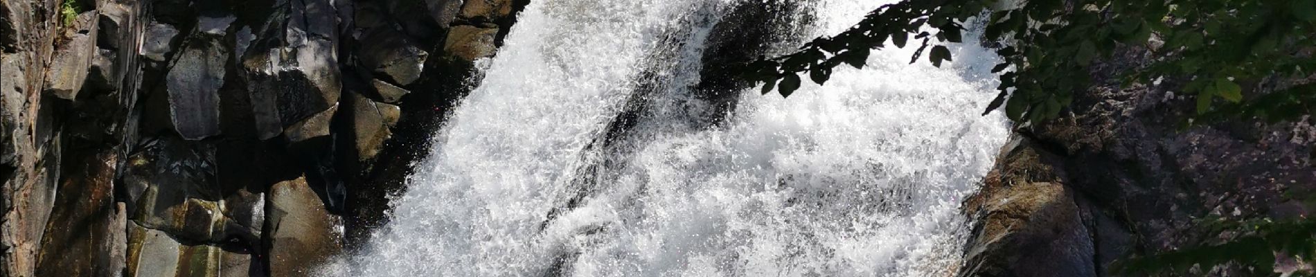
Pont d'Espagne, lac de gaube depuis cauterets

fbienmuller
User
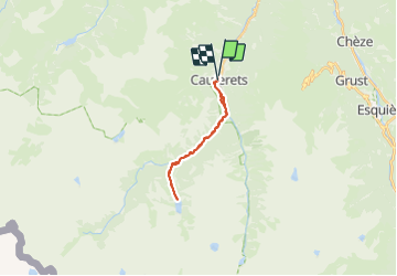

Length
19.8 km

Max alt
1777 m

Uphill gradient
1004 m
Km-Effort
33 km

Min alt
915 m

Downhill gradient
994 m
Boucle
Yes
Creation date :
2023-07-29 07:36:34.773
Updated on :
2023-07-29 15:03:47.887
6h33
Difficulty : Medium

FREE GPS app for hiking
 SityTrail
IGN / Geographical institutes
SityTrail Plus
The world is yours!
About
Trail Walking of 19.8 km to be discovered at Occitania, Hautespyrenees, Cauterets. This trail is proposed by fbienmuller.
Photos


25 photos in total. Please click on a photo to see them all in the gallery.
Positioning
Country:
France
Region :
Occitania
Department/Province :
Hautespyrenees
Municipality :
Cauterets
Location:
Unknown
Start:(Dec)
Start:(UTM)
735628 ; 4752752 (30T) N.
Comments