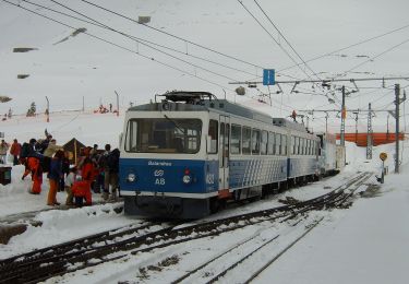
Trail Walking Queralbs - Nuria Puig Mal Col Finestres Nuria - Photo

Nuria Puig Mal Col Finestres Nuria

© OpenStreetMap contributors
Length
Length
12.9 km
Max alt
Max alt
2904 m
Uphill gradient
Uphill gradient
1062 m
Km-Effort
Km-Effort  
27 km
Min alt
Min alt
1963 m
Downhill gradient
Downhill gradient
1062 m
Boucle
Boucle
Yes
Creation date :
2023-07-26 07:19:37.55
Updated on :
2023-07-30 08:54:57.996

(0 Reviews)

Walking
Walking
6h05
Difficulty : Very difficult

Scan this QR Code to open this trail in the SityTrail application

FREE GPS app for hiking

Logo SityTrail SityTrail

IGN / Geographical institutes

Download SityTrail from the App Store Download SityTrail from Google Play

Logo SityTrail SityTrail World

The world is yours!

Download SityTrail from the App Store Download SityTrail from Google Play Download SityTrail on Huawei AppGallery

About

Trail Walking of 12.9 km to be discovered at Catalonia, Girona, Queralbs. This trail is proposed by guyernage25.

Description

Belle expédition montagnarde

Elevation profile

Photos

Positioning

Country:
Spain
Region :
Catalonia
Department/Province :
Girona
Municipality :
Queralbs
Location:
Unknown
Start:(UTM)
430349 ; 4694256 (31T) N.

Trails nearby

Trail On foot Queralbs - Núria-Queralps per pastures i camins miners - Photo
On foot
PRO

On foot

Medium
Queralbs, Catalonia, Girona, Spain
17.1 km | 27 km-effort
6h 10min
No
Trail Walking Queralbs - 2022-06-26_13h04m53_SityTrail - 3293340 - 2022_06_x4-cambre-dxaze - Photo
Walking
chrisgps

Walking

Very difficult
Queralbs, Catalonia, Girona, Spain
15.9 km | 31 km-effort
7h 8min
No
Trail Walking Eyne - vallée eyne et crêtes  - Photo
Walking
HENRYLESTEL

Walking

Difficult
Eyne, Occitania, Pyrénées-Orientales, France
9.5 km | 18.1 km-effort
6h 3min
No
Trail Walking Llo - err retour - Photo
Walking
phil331

Walking

Medium
Llo, Occitania, Pyrénées-Orientales, France
6.5 km | 10.8 km-effort
3h 51min
No
Trail Walking Queralbs - HRP 2022 E 5 Nuria  Ulldeter - Photo
Walking
JACQUOU

Walking

Difficult
Queralbs, Catalonia, Girona, Spain
12.3 km | 25 km-effort
5h 42min
No
Trail On foot Eyne - Py 12 Vallée des Fleurs - la Cabanasse - Photo
On foot
Marcolecomte

On foot

Easy
Eyne, Occitania, Pyrénées-Orientales, France
12.1 km | 15.7 km-effort
3h 34min
No
Trail Walking Fontpédrouse - vallée Caranca. descente abri lac bleu au refuge  - Photo
Walking
RaoulVincent

Walking

Medium
Fontpédrouse, Occitania, Pyrénées-Orientales, France
5.7 km | 7.4 km-effort
2h 41min
No
Trail Walking Queralbs - Puigmal - Photo
Walking
dominiq

Walking

Medium
Queralbs, Catalonia, Girona, Spain
6.5 km | 14 km-effort
2h 48min
No
Trail Walking Eyne - pic d'Eyne - Photo
Walking
RaoulVincent

Walking

Medium
Eyne, Occitania, Pyrénées-Orientales, France
2.2 km | 3.9 km-effort
1h 14min
No


Close
My subscriptions