


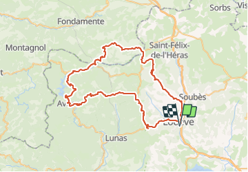
Lodève Labeil Le Clapier Avène Fontbine Lodève

ARVIEU
User

Length
81 km

Max alt
863 m

Uphill gradient
1839 m
Km-Effort
105 km

Min alt
155 m

Downhill gradient
1839 m
Boucle
Yes
Creation date :
2023-07-30 19:51:59.266
Updated on :
2023-07-30 19:53:11.928
4h30
Difficulty : Difficult

FREE GPS app for hiking
 SityTrail
IGN / Geographical institutes
SityTrail Plus
The world is yours!
About
Trail Cycle of 81 km to be discovered at Occitania, Hérault, Lodève. This trail is proposed by ARVIEU.
Positioning
Country:
France
Region :
Occitania
Department/Province :
Hérault
Municipality :
Lodève
Location:
Unknown
Start:(Dec)
Start:(UTM)
525962 ; 4841301 (31T) N.
Comments