


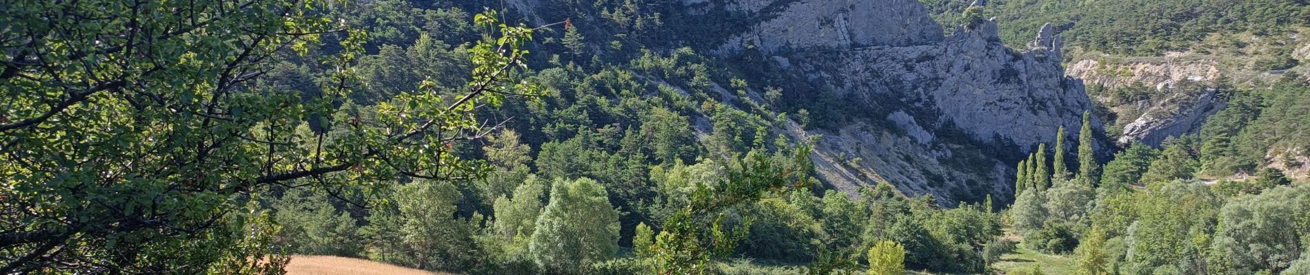
tour des crêtes des aiguilles

chuck
User
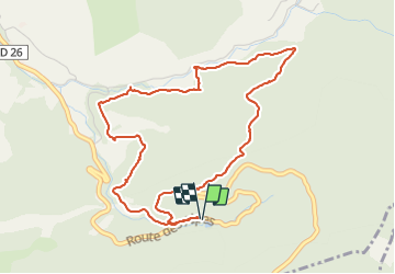

Length
5.3 km

Max alt
1074 m

Uphill gradient
243 m
Km-Effort
8.5 km

Min alt
849 m

Downhill gradient
243 m
Boucle
Yes
Creation date :
2023-07-31 08:14:46.025
Updated on :
2023-07-31 10:20:29.491
2h05
Difficulty : Medium

FREE GPS app for hiking
 SityTrail
IGN / Geographical institutes
SityTrail Plus
The world is yours!
About
Trail Walking of 5.3 km to be discovered at Provence-Alpes-Côte d'Azur, Hautes-Alpes, Valdoule. This trail is proposed by chuck.
Photos


Positioning
Country:
France
Region :
Provence-Alpes-Côte d'Azur
Department/Province :
Hautes-Alpes
Municipality :
Valdoule
Location:
Unknown
Start:(Dec)
Start:(UTM)
704230 ; 4923532 (31T) N.
Comments