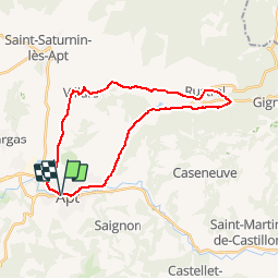
Trail Cycle Apt - Parcours n°8 - Apt - Photo

Randonnées de Vélo Loisir Provence GUIDE+

© OpenStreetMap contributors
Length
Length
27 km
Max alt
Max alt
415 m
Uphill gradient
Uphill gradient
349 m
Km-Effort
Km-Effort  
32 km
Min alt
Min alt
219 m
Downhill gradient
Downhill gradient
349 m
Boucle
Boucle
Yes
Creation date :
2015-01-07 00:00:00.0
Updated on :
2015-01-07 00:00:00.0

(0 Reviews)

Cycle
Cycle
1h50
Difficulty : Medium

Scan this QR Code to open this trail in the SityTrail application

FREE GPS app for hiking

Logo SityTrail SityTrail

IGN / Geographical institutes

Download SityTrail from the App Store Download SityTrail from Google Play

Logo SityTrail SityTrail Plus

The world is yours!

Download SityTrail from the App Store Download SityTrail from Google Play Download SityTrail on Huawei AppGallery

About

Trail Cycle of 27 km to be discovered at Provence-Alpes-Côte d'Azur, Vaucluse, Apt. This trail is proposed by Vélo Loisir Provence.

Description

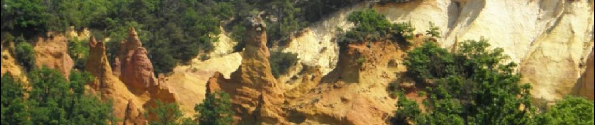
Discover the «Pays des ocres» with its various ochre quaries... Direction of the itinerary : Apt => Rustrel => Villars => Apt

Elevation profile

Photos

Positioning

Country:
France
Region :
Provence-Alpes-Côte d'Azur
Department/Province :
Vaucluse
Municipality :
Apt
Location:
Unknown
Start:(UTM)
692282 ; 4860956 (31T) N.


Close
My subscriptions